Remote sensing is an innovative technology that revolutionizes the agricultural sector by utilizing sensors mounted on aerial or satellite platforms to gather information about crop conditions and land characteristics without the need for physical contact. Through the capture of a broad spectrum of electromagnetic radiation, including both visible and infrared spectra, remote sensing in agriculture offers valuable insights into crucial parameters such as crop health and soil moisture. This non-intrusive approach allows farmers and researchers to efficiently monitor vast agricultural areas, identify disparities in crop vigor, detect early indications of diseases or pests, and optimize the management of resources. From evaluating the effectiveness of irrigation techniques to generating accurate yield forecasts, remote sensing equips the agriculture industry with data-driven decision-making capabilities, ultimately fostering sustainable farming practices and enhancing overall productivity. While remote sensing in agriculture offers numerous benefits, it also comes with certain disadvantages that need consideration.
In this article, we will briefly discuss different types of remote sensing in agriculture and the advantages and disadvantages of remote sensing in agriculture.
Table of Contents
Types of Remote Sensing in Agriculture
Remote sensing in agriculture encompasses various techniques and technologies that capture data from a distance, providing valuable insights into crop health, soil conditions, and overall farm management. Here are some types of remote sensing commonly employed in agriculture:
Satellite Remote Sensing
Satellites equipped with sensors can capture images and collect data across vast agricultural regions. This form of remote sensing offers a comprehensive perspective, enabling the monitoring of crop well-being, alterations in land usage, and the assessment of environmental conditions over a while.
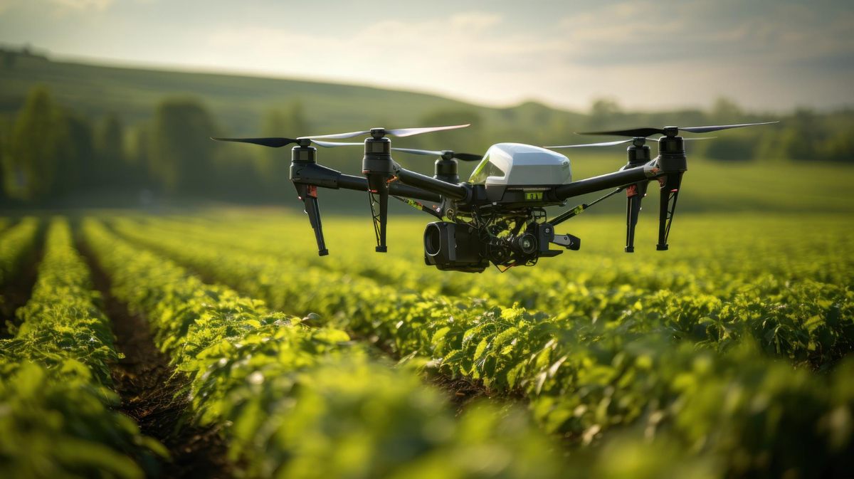
Aerial Remote Sensing
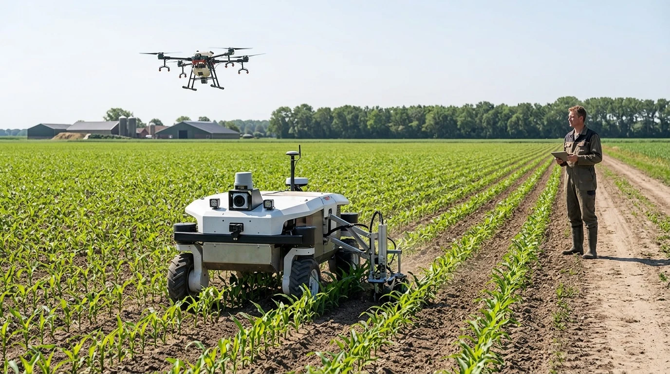
Aerial platforms, such as drones or aircraft, that are equipped with sensors, provide a more comprehensive and localized viewpoint. Aerial remote sensing is highly advantageous for capturing high-resolution images, which facilitates accurate monitoring of crop conditions, pest infestations, and irrigation requirements.
Hyperspectral Remote Sensing
Hyperspectral sensors are capable of capturing data spanning a wide range of wavelengths, thereby offering comprehensive insights into the electromagnetic spectrum. This form of remote sensing proves highly advantageous in discerning distinct crop attributes, assessing nutrient levels, and detecting initial indications of stress or disease.
Thermal Infrared Remote Sensing
Thermal infrared sensors are utilized to measure the temperature of various objects, such as crops and soil. This valuable data helps assess plant water stress, optimize irrigation techniques, and identify areas exhibiting diverse thermal characteristics.
Radar Remote Sensing
Radar sensors employ microwave radiation to penetrate through clouds and vegetation, rendering them highly efficient in various weather conditions. The application of radar remote sensing extends to estimating soil moisture, mapping crops, and monitoring alterations in topography.
GPS Technology
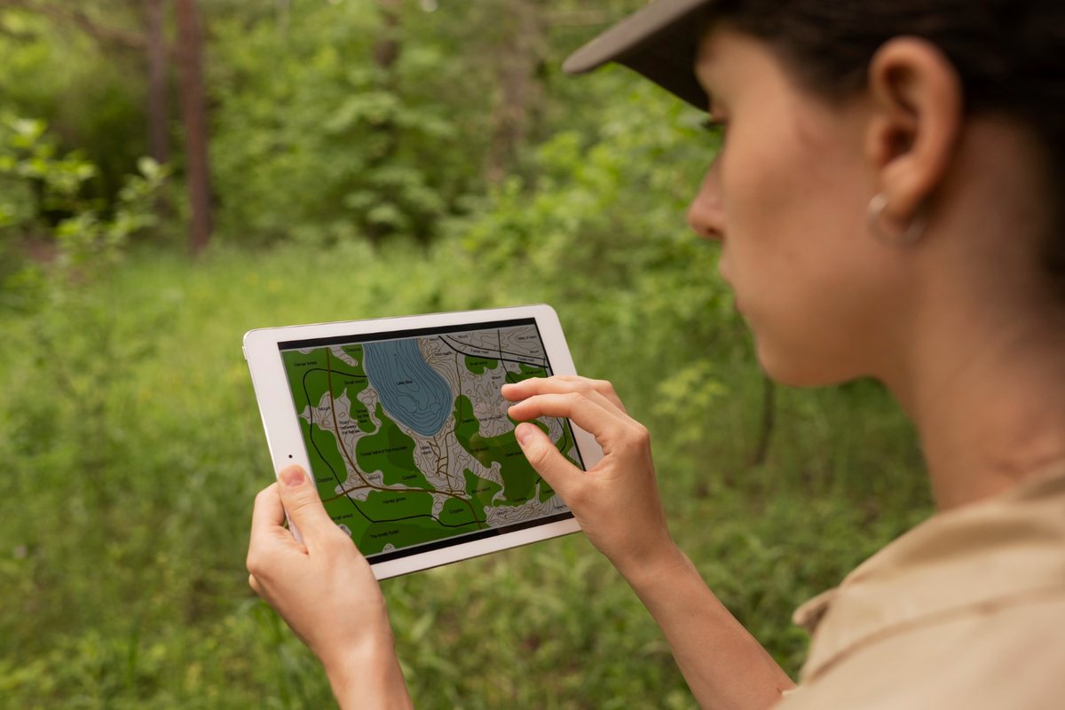
Although not exclusively classified as remote sensing, the integration of GPS (Global Positioning System) technology with remote sensing techniques is a common practice. By offering precise location data, GPS enables the georeferencing of remote sensing data, thereby enhancing the accuracy of mapping and monitoring processes.
Drones
Drones, which are equipped with various sensors, including cameras and multispectral imaging systems, provide a cost-effective and versatile solution for obtaining high-resolution data. These unmanned aerial vehicles are well-suited for tasks such as monitoring crops, detecting diseases, and facilitating precision agriculture applications.
Advantages of Remote Sensing in Agriculture
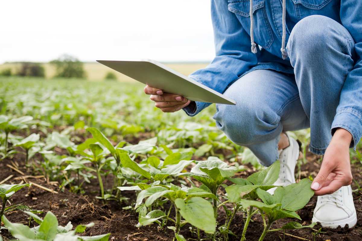
1. Precision Farming
Remote sensing plays a crucial role in facilitating precision farming by offering precise and up-to-date data regarding the spatial diversity within a particular field. This technology empowers farmers to customize their agricultural practices, including irrigation, fertilization, and pesticide application, according to the specific requirements of their crops.
2. Crop Monitoring
Throughout the crop’s growth cycle, the consistent monitoring of the crops enables the prompt identification of irregularities, including pest invasions, diseases, or insufficiencies in essential nutrients. The timely intervention in such cases not only enhances the overall health of the crops but also mitigates any potential losses in yield.
3. Resource Management
Remote sensing in agriculture enables efficient management of resources such as water, fertilizers, and pesticides. By utilizing this technology, farmers can effectively allocate resources according to the specific requirements of different areas within a field. This approach minimizes wastage and reduces the overall environmental impact associated with resource application.
4. Weather Monitoring
Remote sensing plays a crucial role in weather monitoring as it offers valuable insights into temperature, humidity, and precipitation. This information helps farmers anticipate weather-related challenges and plan their activities accordingly.
5. Drought and Stress Detection
Remote sensing in agriculture plays a crucial role in the early identification of drought stress and other environmental stressors. This technology empowers farmers to promptly respond by implementing adaptive measures, including modifying irrigation schedules or selecting drought-resistant crops. By utilizing remote sensing, farmers can proactively address these challenges and mitigate potential crop losses.
6. Mapping Soil Properties
Remote sensing technology has the potential to contribute significantly to the mapping of soil properties, such as moisture levels and nutrient content. This valuable information plays a crucial role in facilitating well-informed decisions regarding soil amendments and effectively enhancing soil health, ultimately leading to enhanced crop productivity.
7. Land Use Planning
Remote sensing plays a crucial role in enhancing land-use planning through the provision of essential data on land cover, land-use alterations, and the expansion of urban areas. This valuable information holds significant importance in promoting sustainable agricultural development and the conservation of natural resources.
8. Cost Savings
Remote sensing plays a crucial role in cost savings for farmers by optimizing resource utilization and reducing inputs in regions with low productivity. This aspect holds significant importance, especially for farmers engaged in large-scale agricultural operations.
Disadvantages of Remote Sensing in Agriculture
1. High Initial Costs
Implementing remote sensing technologies requires a substantial upfront expenditure on equipment, software, and training. This financial barrier can pose a significant obstacle, particularly for small-scale farmers or individuals residing in developing areas.
2. Complexity of Data Interpretation
Analyzing intricate datasets obtained through remote sensing requires a certain level of expertise. The complexity of the data may pose a challenge for farmers and agricultural experts, thereby restricting their ability to effectively utilize this technology.
3. Dependence on Weather Conditions
Weather conditions, such as cloud cover, can hinder the acquisition of satellite or aerial imagery. The unreliability of remote sensing information can be attributed to inconsistent data collection caused by the variability in weather conditions.
4. Lack of Accessibility to Technology
Limited access to the essential technology and infrastructure for remote sensing is prevalent in certain regions, particularly in developing nations. This lack of accessibility can lead to disparities in the adoption of advanced agricultural practices.
5. Data Privacy Concerns
Privacy concerns are a significant issue when it comes to the collection and utilization of remote sensing data, particularly in the context of monitoring individual farms. The apprehension of farmers to disclose sensitive information regarding their agricultural activities is primarily driven by their worries regarding data security and the protection of their privacy.
6. Integration Challenges
Integrating remote sensing data with pre-existing farm management systems can present certain difficulties. The process may encounter obstacles due to compatibility issues arising from the use of diverse technologies and data formats, thereby impeding the smooth integration of these systems.
7. Overemphasis on Technology
Overemphasizing technology by solely relying on remote sensing data, without taking into account traditional knowledge and on-the-ground observations, may result in a potential disconnection between farmers and their expertise, as well as the intricate details of local conditions.
8. Risk of Misinterpretation
Misunderstanding remote sensing data can give rise to incorrect conclusions about crop health, pest infestations, or other variables. Such misinterpretation can consequently lead to suboptimal decision-making and inefficient allocation of resources.
Conclusion
In conclusion, remote sensing in agriculture is a transformative approach that utilizes cutting-edge technology to revolutionize conventional farming methods. It enables farmers to predict yields, classify crop types, and monitor weather conditions. Remote sensing empowers them to make well-informed decisions, thereby contributing to efficient land use planning. However, there are certain obstacles associated with these advancements. Striking a balance between affordability, accessibility, and technological sophistication is crucial to ensure that the benefits of remote sensing are accessible to farmers across diverse landscapes. As technology continues to advance and become more user-friendly, addressing these challenges will pave the way for a future where remote sensing becomes an integral and indispensable tool, fostering a resilient agricultural landscape driven by data.